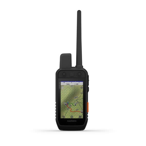
Alpha® 200i
<p><a href="https://explore.garmin.com/en-AU/inreach/#subscriptions">Learn more about inReach satellite subscription plans</a></p>
Overview
STRONG CONNECTION. STRONG BOND.
This system is designed to help make tracking and training simple, accessible and fast.
Keep inactive dogs in the system for easier setup and management.
Navigate every hunt with the best in Garmin mapping and sensors.
User-replaceable battery lasts up to 20 hours; up to 15 hours with inReach technology enabled.
Take dog tracking and training to the next level.
TRACK YOUR PACK
Monitor up to 20 dogs from up to %%10 km (depending on dog collar) with a 2.50-second update rate.
DOG LIST/GROUP MANAGEMENT
Keep inactive dogs in your dog list, and manage active groups so you don’t have to add and remove dogs for every hunt.
HUNT METRICS
SIX-BUTTON DESIGN
Use dedicated buttons for fast training cues and minor adjustments in the field.
18 LEVELS OF STIMULATION
Momentary and continuous stimulation options let you customise training for each dog.
TONE/VIBRATION
Deliver audible tone or vibration training commands for quick adjustments to individual dogs, when your Alpha device is paired with your compatible training-enabled collar.
GARMIN EXPLORE™ APP
OPTIONAL INREACH WEATHER
PRO VIEW COMPASS
The pro view compass mode gives you simple, at-a-glance tracking that shows which direction and how far away your dogs are, plus you will see when a dog is Treed or OnPoint.
Navigate your surroundings.
MULTI-GNSS SUPPORT
Access multiple global navigation satellite systems (GPS and Galileo) to track your pack with greater accuracy than GPS alone.
TOPOACTIVE MAPS
Our preloaded TopoActive mapping provides detailed views of terrain contours, topographic elevations, summits, parks, coastlines, rivers, lakes and geographical points.
BIRDSEYE DIRECT
Download BirdsEye Satellite Imagery directly to the handheld for better-than-real-life views of your route, trailheads, clearings and more.
NAVIGATION SENSORS
A barometric altimeter helps you accurately monitor ascent and descent and see short-term trends in air pressure, and the built-in tilt-compensated three-axis electronic compass keeps your bearing — whether you’re moving or not.
SEE IT ALL
The sunlight-readable 3.50” capacitive touchscreen display makes it easy to see and interact with your maps, dog data and more — even while wearing gloves.
STAY ON THE MOVE
Replaceable battery lasts up to 20 hours, or up to 15 hours with inReach technology enabled.
ADDITIONAL MAPPING
Stay in touch using inReach technology.